Advanced Certificate in Spatial Data Analysis: Techniques and Applications in Mapping
Gain expertise in spatial data analysis, mastering techniques for mapping and geospatial applications to enhance decision-making and problem-solving skills.
Advanced Certificate in Spatial Data Analysis: Techniques and Applications in Mapping
Programme Overview
This course is for professionals and students seeking to advance their spatial data analysis skills. First, you will learn to harness the power of Geographic Information Systems (GIS). Then, you will dive into spatial statistics. Moreover, you will explore cutting-edge mapping techniques. Next, you will work on real-world projects.
Firstly, you will gain hands-on experience with industry-standard software. Secondly, you will develop the ability to interpret and visualize complex spatial data. Lastly, you will be equipped to apply these skills in various fields such as urban planning, environmental management, and business analytics.
What You'll Learn
Ready to elevate your skills and unlock the power of spatial data? Enroll in our Advanced Certificate in Spatial Data Analysis: Techniques and Applications in Mapping. This program dives into the world of geospatial technology, equipping you with cutting-edge tools to analyze and visualize data. First, you'll master advanced techniques in Geographic Information Systems (GIS). Next, you'll learn to apply these skills across various fields, from urban planning to environmental conservation.
Moreover, you'll gain hands-on experience with industry-leading software, ensuring you're job-ready upon completion. Finally, you'll join a vibrant community of professionals and gain access to exclusive networking events. Career opportunities abound in government agencies, private consulting firms, and non-profit organizations. Furthermore, graduates often find themselves in high-demand roles as GIS Analysts, Urban Planners, or Environmental Scientists. Don't miss this chance to transform your career. Enroll today and become a spatial data pioneer!
Programme Highlights
Industry-Aligned Curriculum
Developed with industry leaders for job-ready skills
Globally Recognised Certificate
Recognised by employers across 180+ countries
Flexible Online Learning
Study at your own pace with lifetime access
Instant Access
Start learning immediately, no application process
Constantly Updated Content
Latest industry trends and best practices
Career Advancement
87% report measurable career progression within 6 months
Topics Covered
- Geospatial Data Acquisition: Methods for collecting and managing spatial data from various sources.
- Spatial Data Structures: Understanding and implementing data models for efficient spatial data storage.
- Geospatial Analysis Techniques: Advanced methods for analyzing spatial patterns and relationships.
- Geostatistics and Interpolation: Techniques for predicting spatial data values based on sampled data points.
- Geographic Information Systems (GIS) Applications: Practical applications of GIS in urban planning, environmental management, and more.
- Cartography and Visualization: Creating effective maps and visualizations to communicate spatial information.
What You Get When You Enroll
Secure checkout • Instant access • Certificate included
Key Facts
For Whom? This program targets professionals and students eager to boost their skills in spatial data analysis and mapping. It includes you if you are a geographer, urban planner, environmental scientist, or anyone interested in spatial analysis. Moreover, it welcomes those from related fields seeking to expand their toolkit.
Prior Knowledge?
First, you need a bachelor's degree or equivalent in a relevant field. Before diving in, ensure you have basic knowledge of statistics and experience with GIS software. Then, you're ready to start learning advanced techniques and applications.
After Completion:
Once you finish, you will actively apply advanced spatial analysis techniques. Meanwhile, you will create and interpret complex maps and models. Finally, you will confidently tackle real-world spatial data challenges.
Ready to get started?
Join thousands of professionals who already took the next step. Enroll now and get instant access.
Enroll Now — $149Why This Course
Firstly, this certificate equips learners with cutting-edge skills in spatial data analysis. Consequently, graduates can tackle real-world mapping challenges. Moreover, they will be able to work in various industries like urban planning, environmental management, and logistics.
Secondly, the course offers hands-on training. Therefore, learners gain practical experience. Furthermore, this experience makes them job-ready from day one.
Lastly, the program is designed to be flexible. Thus, learners can study at their own pace. Since it accommodates busy schedules, anyone can enhance their skills without disrupting their current commitments.
Your Path to Certification
From enrollment to certification in 4 simple steps
instant access
pace, anywhere
quizzes
digital certificate
Join Thousands Who Transformed Their Careers
Our graduates consistently report measurable career growth and professional advancement after completing their programmes.
Course Brochure
Download our comprehensive course brochure with all details
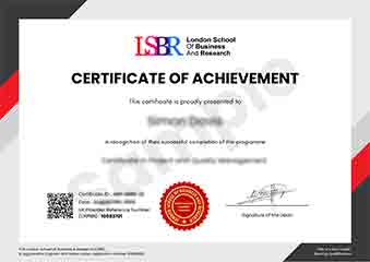
Sample Certificate
Preview the certificate you'll receive upon completion.
Employer Sponsored Training
Let your employer invest in your professional development. Request a corporate invoice and get your training funded.
Request Corporate InvoiceWhat People Say About Us
Hear from our students about their experience with the Advanced Certificate in Spatial Data Analysis: Techniques and Applications in Mapping at CourseBreak.
James Thompson
United Kingdom"The course material was incredibly comprehensive, covering everything from GIS fundamentals to advanced spatial analysis techniques. I gained practical skills in using various mapping software and tools, which have already proven valuable in my current role."
Jack Thompson
Australia"Completing the Advanced Certificate in Spatial Data Analysis has been a game-changer for me. The course provided me with highly relevant industry skills, particularly in mapping techniques, which have significantly enhanced my ability to analyze and interpret spatial data in my current role. This has not only boosted my confidence but also opened up new career opportunities, making me a more valuable asset to my team."
Charlotte Williams
United Kingdom"The course structure was exceptionally well-organized, with each module building logically on the previous ones, making complex topics in spatial data analysis accessible and engaging. The comprehensive content not only deepened my understanding of mapping techniques but also provided valuable insights into real-world applications, significantly enhancing my professional growth."
Still deciding?
Join 23,000+ professionals who advanced their careers. Enroll today and start learning immediately.
Enroll NowSecure payment • Instant access • Certificate included