Executive Development Programme in Interactive Mapping and Geospatial Analysis
This program equips executives with advanced skills in interactive mapping and geospatial analysis, enhancing strategic decision-making and data-driven insights.
Executive Development Programme in Interactive Mapping and Geospatial Analysis
Programme Overview
The 'Executive Development Programme in Interactive Mapping and Geospatial Analysis' is designed for professionals seeking to enhance their skills in geospatial technology. It includes business analysts, urban planners, and project managers aiming to leverage geographic information systems (GIS) for decision-making. Furthermore, it welcomes anyone from various backgrounds looking to upskill in this domain. Participants will gain hands-on experience with cutting-edge tools and techniques. They'll learn to create, analyze, and interpret spatial data.
Firstly, participants will gain expertise in interactive mapping. Next, they'll explore geospatial analysis methods. Moreover, they'll master software like ArcGIS, QGIS, and Python for geospatial applications. Ultimately, they'll be equipped to apply these skills in their respective fields, driving innovation and efficiency.
What You'll Learn
Dive into the dynamic world of geospatial analysis with our Executive Development Programme in Interactive Mapping and Geospatial Analysis. First, learn to harness the power of maps and spatial data. Consequently, you will understand how to extract meaningful insights from complex datasets. Next, master cutting-edge tools and technologies, including GIS software and interactive mapping platforms. Moreover, gain hands-on experience through real-world projects, allowing you to apply your skills in practical scenarios. Benefit from expert-led sessions and collaborative learning environments, ensuring you stay ahead in this rapidly evolving field. Furthermore, this program opens doors to diverse career opportunities in urban planning, environmental management, public health, and more. Don't miss this chance to transform your career. Enroll now and become a leader in geospatial innovation!
Programme Highlights
Industry-Aligned Curriculum
Developed with industry leaders for job-ready skills
Globally Recognised Certificate
Recognised by employers across 180+ countries
Flexible Online Learning
Study at your own pace with lifetime access
Instant Access
Start learning immediately, no application process
Constantly Updated Content
Latest industry trends and best practices
Career Advancement
87% report measurable career progression within 6 months
Topics Covered
- Introduction to Geographic Information Systems: Learn the fundamentals of GIS technology and its applications.
- Spatial Data Acquisition and Management: Explore methods for collecting, storing, and managing geospatial data.
- Geospatial Analysis Techniques: Understand and apply various analytical methods in geospatial data.
- Interactive Mapping and Visualization: Create dynamic and interactive maps using modern tools.
- Advanced Geospatial Data Analysis: Dive deeper into complex geospatial analysis techniques.
- Project Implementation and Case Studies: Apply learned skills to real-world projects and case studies.
What You Get When You Enroll
Secure checkout • Instant access • Certificate included
Key Facts
### Key Facts
Audience:
This program is designed for professionals eager to enhance their skills in interactive mapping and geospatial analysis. It caters to individuals from various backgrounds, including urban planners, environmental scientists, and business analysts. First, you will join a diverse group of learners.
Prerequisites:
Before enrolling, participants should have basic computer skills. Familiarity with geographic information systems (GIS) is beneficial but not required. Moreover, a willingness to learn and adapt to new technologies is crucial.
Outcomes:
First, you will gain hands-on experience with cutting-edge mapping tools. Next, you will learn to analyze geospatial data effectively. Finally, you will be able to create interactive maps to support decision-making processes.
Ready to get started?
Join thousands of professionals who already took the next step. Enroll now and get instant access.
Enroll Now — $199Why This Course
Learners should pick the 'Executive Development Programme in Interactive Mapping and Geospatial Analysis' because it offers unique advantages. Firstly, it enhances your skills. You can master the latest tools and technologies in the field, such as GIS software. Next, it promotes collaboration. You'll work on real-world projects with peers. Besides, it boosts your career prospects. You can gain practical experience and network with industry professionals. Additionally, it fosters continuous learning. You can stay updated with the latest trends. Overall, it empowers learners with invaluable skills. Make sure you have a growth mindset.
3-4 Weeks
Study at your own pace
Course Brochure
Download our comprehensive course brochure with all details
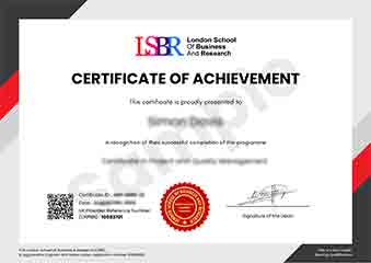
Sample Certificate
Preview the certificate you'll receive upon completion.
Employer Sponsored Training
Let your employer invest in your professional development. Request a corporate invoice and get your training funded.
Request Corporate InvoiceYour Path to Certification
From enrollment to certification in 4 simple steps
instant access
pace, anywhere
quizzes
digital certificate
Join Thousands Who Transformed Their Careers
Our graduates consistently report measurable career growth and professional advancement after completing their programmes.
What People Say About Us
Hear from our students about their experience with the Executive Development Programme in Interactive Mapping and Geospatial Analysis at CourseBreak.
Sophie Brown
United Kingdom"The course content was incredibly comprehensive, covering everything from basic GIS principles to advanced interactive mapping techniques. I gained practical skills in using geospatial software that I can immediately apply in my current role, making this program a valuable investment for my career."
Isabella Dubois
Canada"The Executive Development Programme in Interactive Mapping and Geospatial Analysis has been a game-changer for my career. I've gained industry-relevant skills that have allowed me to apply geospatial analysis to real-world projects, leading to significant career advancement and recognition within my organization."
Greta Fischer
Germany"The course structure was incredibly well-organized, with each module building seamlessly upon the last, which made complex topics in interactive mapping and geospatial analysis much more digestible. I found the content to be comprehensive and directly applicable to real-world scenarios, significantly enhancing my professional toolkit and boosting my confidence in handling geospatial data."